

Floor space ratio in NSW is the ratio of a building's total Gross Floor Area (GFA) to the site area, expressed as a number followed by ":1" — for example, 0.5:1. The formula is simple: FSR × site area = maximum GFA. On a lot with an FSR of 0.5:1, you can build up to half the lot's area as gross floor area across all structures on the site.
Here is how to check the FSR for your property right now:
- Go to the NSW Planning Portal Spatial Viewer and enter your property address or lot number.
- Turn on the FSR map layer under the planning or zoning controls panel; the map will display the maximum FSR value assigned by your local council's Local Environmental Plan (LEP).
- Note the numeric FSR value and the LEP clause reference shown (typically clause 4.4 or 4.5) — then open the LEP document itself to confirm any tables or site-specific rules that may apply.
One caveat before you run the numbers: the FSR on the map is a ceiling, not a promise. Height limits, setbacks, heritage overlays, and parking requirements can all reduce what you can actually build, even when the arithmetic looks generous.
Table of Contents
- What does floor space ratio mean for NSW development?
- How do you calculate FSR in NSW?
- What counts as Gross Floor Area in NSW?
- How do you check the FSR for a specific NSW property?
- How does FSR interact with other planning controls?
- What are your options if you need more floor area in NSW?
- Common mistakes people make when using FSR
- How Navilot helps NSW homeowners prepare for FSR decisions
- Key Takeaways
- The part most homeowners skip — and why it costs them
- Get a personalised roadmap for your NSW property
- Authoritative sources to check next
What does floor space ratio mean for NSW development?
FSR is the planning system's primary tool for controlling built bulk. It does not directly regulate how tall a building is or where it sits on the lot — that is the job of height limits and setbacks. What it does is cap the total amount of enclosed floor space relative to the land beneath it, which keeps density in check across a zone.

The legal definition sits in the Standard Instrument Local Environmental Plan. Clause 4.5 of the Standard Instrument sets out the rules for calculating both FSR and site area, including how to handle multiple lots and existing buildings. Clause 4.4 is the operative control — it is the clause in each council's LEP that actually specifies the maximum FSR for a given parcel of land, either on an FSR map or through a table that varies the ratio by land use or site dimensions.
The NSW Department of Planning and Environment's practice note PN 08-001 explains that councils can apply different FSRs across different parts of a zone and may use tables that vary the permissible ratio depending on the proposed land-use mix or site dimensions. That means two adjacent lots in the same zone can legally have different FSR entitlements if the LEP table distinguishes them by use or size.
For property owners and developers, FSR sets the economic yield of a site. A higher FSR means more lettable or saleable floor area from the same land. For that reason, FSR is often the first number a feasibility assessment reaches for — but it is rarely the only number that matters.
How do you calculate FSR in NSW?
The formula and units
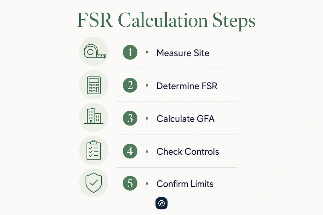
The calculation itself is straightforward. GFA and site area are both measured in square metres. Divide total GFA by site area and you get the FSR as a decimal; express it as a ratio by appending ":1."
FSR = Total GFA ÷ Site Area
To find maximum allowable GFA, rearrange: Maximum GFA = FSR × Site Area
Measuring site area
Site area is the area of the lot (or lots) as shown on the title, minus any land that Clause 4.5 excludes — such as certain public land or land subject to a consent condition restricting floor area. When you are developing across multiple lots, aggregation is only permitted when the lots physically share a common boundary and the additional lot is the subject of significant development. Common ownership alone does not allow you to combine site areas.
Clause 4.5 also contains anti-double-dipping provisions: a consent condition can require a covenant to be registered on a restricted lot, preventing that lot's area from being counted again in a future aggregation.
Worked example 1: Single-storey residential
| Item | Value |
|---|---|
| Site area | a typical residential lot size |
| Applicable FSR (LEP) | a moderate value such as 0.5:1 |
| Maximum GFA | half the site area |
| Proposed new dwelling GFA | less than maximum GFA |
| Remaining GFA headroom | the difference between maximum and proposed GFA |
The 45 m² headroom could accommodate a small garage or future addition, provided other controls (setbacks, height) also permit it.
Worked example 2: Multi-storey mixed-use
| Item | Value |
|---|---|
| Site area | a large urban lot |
| Applicable FSR (LEP) | a higher value often above 2:1 |
| Maximum GFA | multiple times the site area |
| Existing ground-floor retail GFA (retained) | included in total GFA |
| Available GFA for new residential floors | the remaining floor area after existing uses |
| Approximate residential floors | calculated by dividing remaining GFA by typical floor plate |
Notice that the existing retail GFA is counted first. Clause 4.5 requires all existing buildings within the vertical projection of the site to be included in the total floor space calculation. Forgetting this is one of the most common errors in early feasibility work.
Pro Tip: Always check whether your council's LEP uses a sliding-scale FSR table rather than a single map value. A mixed-use site in some councils attracts a higher FSR than a purely residential one on the same land — the difference can be significant for feasibility.
What counts as Gross Floor Area in NSW?
GFA is measured from the internal face of external walls at 1.4 m above floor level. That measurement height is the key threshold: any wall element that reaches 1.4 m or higher on the outside face is treated as an external wall for GFA purposes, and the floor area inside it counts.
Typical inclusions
- All habitable rooms: bedrooms, living areas, kitchens, bathrooms, studies
- Balconies and terraces where the outer walls or balustrades exceed 1.4 m in height
- Basement rooms classified as habitable (e.g., a media room or bedroom with compliant natural light)
- Internal corridors, stairwells, and lift shafts at each floor level
- Mezzanine levels and loft spaces with adequate headroom
- Plant rooms and garbage rooms that are enclosed within the building envelope
Typical exclusions
The Housing Code lists the standard exclusions clearly:
- Basement areas used solely for storage (not habitable)
- Vehicular access ramps and driveways within the building
- One car parking space and the access to it (per dwelling, under the Housing Code)
- Terraces and balconies where outer walls or balustrades are less than 1.4 m high
- Voids above a floor at storey level (open double-height spaces)
- Loading areas and service areas for vehicles
Edge cases that cause disputes
GFA interpretation is a frequent source of legal conflict in NSW, and courts have had to resolve a number of recurring ambiguities:
- Semi-enclosed balconies ("winter gardens"): If a balcony is enclosed with glazing that reaches 1.4 m or higher, it may be treated as internal GFA rather than an excluded terrace. The precise wall treatment determines the outcome.
- Motorbike parking: Courts have confirmed that motorbike parking can be treated as car parking for exclusion purposes, but only when the LEP wording supports it.
- Basement habitable rooms: Whether a basement room is "habitable" turns on ventilation, natural light, and ceiling height — not just the owner's intended use.
- Plant rooms: Enclosed plant rooms within the building footprint are generally included unless the LEP specifically excludes them.
- Unconventional wall treatments: Architectural screens or louvres that reach 1.4 m can convert what looks like open space into counted GFA when councils or courts apply the measurement rule strictly.
Pro Tip: Before preparing a formal GFA schedule for a DA, check the specific wording in your local LEP and any recent Land and Environment Court decisions on similar building types. The Standard Instrument definition is the baseline, but local variations and case law can shift the outcome.
How do you check the FSR for a specific NSW property?
Step-by-step using the NSW Planning Portal
The NSW Planning Portal Spatial Viewer is the official starting point. Here is the workflow:
- Search the property — Enter the street address or lot and deposited plan number in the search bar.
- Activate the FSR layer — Under the planning controls or zoning panel, turn on the FSR (or "Floor Space Ratio") map layer. The map will shade the site and display the maximum FSR value from the applicable LEP.
- Open the LEP document — Click through to the LEP or go to the NSW legislation website to read clause 4.4 and any associated FSR tables. The map alone may not reveal sliding-scale rules or mixed-use variations.
Limitations to watch for
Map boundaries do not always align perfectly with lot boundaries, particularly on corner sites or lots that straddle two zones. If your site sits near a zoning boundary, the FSR layer may show two different values — one for each zone. In that case, the LEP text and the council's GIS team are the authoritative sources.
Some councils apply development-priority overlays or site-specific clauses that override the standard FSR map value. These are not always visible in the spatial viewer at first glance.
Pro Tip: After checking the portal, call the council's duty planner and ask specifically: "Does clause 4.4 of your LEP apply a table-based or site-specific FSR to this lot?" A five-minute call can save weeks of design work based on the wrong number.
How does FSR interact with other planning controls?
FSR rarely operates alone. Even when the arithmetic says you can build 800 m² of GFA, the site may only physically accommodate 500 m² once height limits, setbacks, solar access planes, and parking requirements are applied. The DPE practice note PN 08-001 explicitly advises that FSR and height controls should be applied together, with supporting calculations that demonstrate compliance with both.
Common controls that reduce achievable GFA
- Environmental constraints: — Flood planning levels, bushfire attack levels, and biodiversity overlays can all reduce the buildable area of a site regardless of the mapped FSR.
How the controls interact in practice
| Control | Purpose | Typical FSR interaction |
|---|---|---|
| Height limit | Caps building height in metres or storeys | Limits how many floors can be stacked to reach maximum GFA |
| Setbacks | Maintains separation from boundaries | Reduces buildable footprint; can make maximum GFA unachievable on narrow lots |
| Heritage constraints | Protects character and scale | May impose lower effective bulk than the mapped FSR allows |
| Solar access planes | Protects neighbour amenity | Forces upper-floor setbacks that reduce GFA on upper levels |
| Parking minimums | Provides on-site parking | Consumes site area and basement volume that could otherwise contribute to GFA |
| Infrastructure contributions | Funds public infrastructure | Does not reduce GFA directly but adds cost that affects feasibility |
The practical sequencing that works: commission a site survey first, then run a concept design that layers height and setback controls over the FSR envelope, then do a GFA audit of that concept. Only at that point do you have a realistic yield figure to take to a feasibility model.
What are your options if you need more floor area in NSW?
When the mapped FSR is not enough for your project, there are several routes — none of them quick or guaranteed.
Clause 4.6 variation
Clause 4.6 of the Standard Instrument LEP is the formal mechanism for seeking an exception to a development standard, including FSR. To succeed, an applicant must demonstrate that compliance with the standard is unreasonable or unnecessary in the circumstances, and that the variation is consistent with the objectives of the standard and the zone. Councils assess these on merit, and the bar is genuinely high for FSR variations—courts have consistently required strong, site-specific justification rather than general arguments about project viability.
Engaging a town planner to prepare the Clause 4.6 written request is not optional; it is the difference between a credible submission and a refusal. A development application that includes a Clause 4.6 request also needs a Statement of Environmental Effects that directly addresses the variation — see the guidance on preparing an SEE for NSW for what councils expect in that document.
Planning proposal or rezoning
If the FSR limit is fundamentally misaligned with the site's potential, a planning proposal to amend the LEP is the longer-term route. This is a statutory process that goes through the council, the Department of Planning and Environment, and sometimes a Gateway determination. Timelines are typically measured in years, not months, and costs include planning consultants, traffic studies, urban design reports, and council fees. Rezoning is a realistic option for larger sites or strategic locations, but it is not a shortcut.
Redesign to fit within controls
Often the most practical answer is a design that maximises GFA within the existing controls rather than seeking an exception. An architect or building designer experienced in GFA optimization can sometimes recover significant floor area by rethinking the building form, adjusting wall treatments to keep balconies below the 1.4 m threshold, or relocating plant rooms. This approach costs less and moves faster than any variation or rezoning.
Common mistakes people make when using FSR
Getting FSR wrong at the feasibility stage is expensive. These are the errors that come up repeatedly:
- Using the wrong site area. Measuring from the fence line rather than the title boundary, or including a right-of-way strip that belongs to the road reserve, inflates the site area and produces an overstated GFA entitlement.
- Forgetting existing building GFA. On a site with an existing structure you plan to retain, that building's GFA counts against the FSR limit from day one. Ignoring it means the new addition may exceed the maximum before a single new wall goes up.
- Treating the map value as the final answer. The spatial viewer shows the base FSR. It does not show site-specific clauses, sliding-scale tables, or development-priority overlays that may apply a different value to your lot.
- Ignoring covenants and easements. A registered covenant can restrict the type or amount of development on a lot independently of the LEP. Title searches are not optional.
- Assuming FSR is the binding constraint. On many residential lots, setbacks and height limits are what actually limit the building, not FSR. Running the FSR calculation without also checking the other controls produces a misleading yield estimate.
What to do instead
Call the council's duty planner and ask for the LEP clause reference, the applicable FSR table (if any), and whether any site-specific provisions apply. Order a title search and check for covenants before spending money on design. If the GFA calculation is critical to the project's viability, commission a professional GFA audit from a registered surveyor or an architect with GFA experience — the cost is small relative to the risk of a DA refusal based on an incorrect floor area schedule.
When it comes to organising the documents you will need, Navilot's guided questionnaire and checklist workspace help homeowners pull together title documents, LEP references, and council correspondence before any formal lodgement.
How Navilot helps NSW homeowners prepare for FSR decisions
Navilot is a preparation platform, not an approval service. The distinction matters: Navilot does not lodge development applications, provide legal advice, or guarantee any planning outcome. What it does is help homeowners get organised before they engage council or a professional, so that time and money are not wasted on avoidable back-and-forth.
For a homeowner planning a granny flat, a garage conversion, or a modest extension, the platform works like this: you answer a guided property questionnaire about your site, your project, and your local council. Navilot uses those answers to generate a tailored roadmap that identifies the likely approval pathway (complying development or DA), the documents you will probably need, and the council-specific requirements that apply to your project type. The workspace lets you organise those documents in one place before you book a pre-application meeting or engage a designer.
Navilot is most useful at the early stage — when you are trying to understand whether your project is feasible, what the process looks like, and what you need to prepare. For granny flat approvals in NSW, where GFA and site coverage rules interact in ways that catch many homeowners off guard, having a clear checklist before the first council conversation can save weeks.
The platform refers users to professionals (architects, town planners, surveyors) when the project complexity goes beyond preparation. Navilot does not replace those professionals; it helps you arrive at their door ready.
Key Takeaways
The FSR on the NSW Planning Portal map is your starting point, not your final answer — always confirm the LEP clause, check for tables, and layer other controls before drawing conclusions about buildable area.
| Point | Details |
|---|---|
| FSR formula | Maximum GFA = FSR × site area; both measured in square metres. |
| Check the portal first | Use the NSW Planning Portal Spatial Viewer to find the FSR layer, then read the LEP clause for tables or site-specific rules. |
| GFA has strict inclusions | Measure from the internal face of external walls at 1.4 m; balconies above that height count, parking and low balustrades generally do not. |
| FSR is a ceiling, not a guarantee | Height limits, setbacks, heritage, and parking requirements often reduce achievable GFA below the mapped maximum. |
| Navilot for preparation | Navilot's guided questionnaire and roadmap help homeowners organise documents and understand their approval pathway before engaging council or professionals. |
The part most homeowners skip — and why it costs them
Most people who look up their FSR stop at the number on the map. They do the multiplication, get excited about the GFA they think they can build, and brief a designer based on that figure. Then the designer comes back three weeks later with a scheme that does not work because the setbacks eat the footprint, or the height limit prevents the third floor, or there is a covenant on the title that nobody checked.
The FSR number is genuinely useful — it tells you the theoretical ceiling. But the ceiling is not the floor. Every site has a gap between what the FSR permits in theory and what the other controls allow in practice, and that gap is where feasibility assessments go wrong.
The homeowners who navigate this well are the ones who check FSR, height, setbacks, and title encumbrances at the same time, before spending money on design. That early discipline does not require a planning degree. It requires knowing which questions to ask and where to look — which is exactly the gap that a preparation platform like Navilot is built to close.
Get a personalised roadmap for your NSW property
Knowing your FSR is step one. Knowing what to do with it — which pathway to take, which documents to gather, which council requirements apply to your specific project — is where most homeowners get stuck.
Navilot builds you a tailored pre-application roadmap based on your property, your project type, and your local council. The roadmap includes a property questionnaire, identification of your likely approval pathway (complying development or DA), a checklist of required documents, and council-specific notes for your project. It is not council approval or legal advice — it is the organised preparation that makes your first professional conversation count.
Start free, then get your full roadmap when you are ready to move forward. Check which councils and project types Navilot covers before you begin.
Authoritative sources to check next
These are the primary references for FSR rules, definitions, and mapping tools in NSW:
- NSW Planning Portal Spatial Viewer — the official mapping tool for checking the FSR layer and LEP name for any NSW property address or lot.
- DPE Practice Note PN 08-001 — Height and Floor Space Ratio — explains how clause 4.4 and 4.5 work in practice, including variable FSR bands and the relationship between FSR and height controls.
- Housing Code — NSW Planning Portal — sets out GFA measurement rules and standard exclusions for residential complying development.
- Standard Instrument — Principal Local Environmental Plan (full text) — the complete Standard Instrument LEP, including all compulsory and optional clauses that councils adopt.